THE INVISIBLE URBAN CRISIS: MAPPING HIDDEN HOUSING INEQUALITY IN NAIROBI
By Sharonne Kemboi
When we first mapped Nairobi’s fastest-growing neighborhoods, we expected to find overcrowding. What we uncovered was far more troubling—entire communities, homes, and lives vanishing from official records as if they’d never existed. Not by bulldozers. But by biased data.
What the Maps Missed: The Data That Changed Everything
The Ghost Neighborhoods:
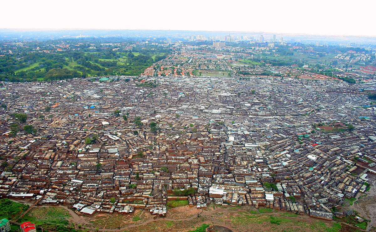
Our AI model revealed three dense, vibrant communities completely missing from government records. Over 12,000 residents, living without access to clean water, were excluded from official planning because the land they occupied was unregistered. In the eyes of city systems, they didn’t exist.
Displacement in Disguise:
In what many assume are stable, middle-income neighborhoods, rent hikes told another story. Our data showed that areas near new roads experienced rent increases 40% faster than average. Teachers, nurses, and small-business owners were being priced out of the very areas they helped build.
Putting a Face to the Data: The Wanjiku Family
Grace Wanjiku had rented the same home in Kibera for eight years. She raised her children there, paid rent on time, and had deep roots in her community. But then a developer’s predictive model labeled her neighborhood as “high potential.” Almost overnight, eviction notices were sprayed on doors with red Xs. Grace received no warning.

She spent six months fighting to prove she lived there. With the help of timestamped geospatial evidence collected by our team, she succeeded. Today, she lives in a safer home and holds a document titled “Proof of Existence,” co-created through our advocacy work.
When Maps Lie (And How We’re Rewriting Them)
In many urban systems, if a location isn’t taxed, it doesn’t appear on official maps. That means schools, homes, clinics—entire neighborhoods—can be labeled “vacant land.” One school we found, serving over 300 children, was marked as an empty lot.
To challenge this, we blended satellite imagery with on-the-ground data collection: community walks, SMS surveys, and interviews. The result? A living map that updates in real-time as residents report changes in their neighborhoods.
A Call to Action: Who Gets to Be Seen?
To fellow technologists: Algorithms don’t displace people, but they make it dangerously easy. We’ve open-sourced our toolkit for auditing housing-related AI models—use it. Question your data sources. Ask who is left out.
Because when maps lie, communities disappear. But when we center people in data, we don’t just build better cities—we build fairer futures.